Overview
What is an Incident Map?
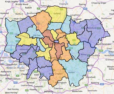
The Incident Maps are an online tool which show the number of fire related incidents London Fire Brigade have attended across London.
In more detail
You can use the map to look at individual borough incident statistics. There is a summary option once you click on the particular borough or you can compare your area to the London average.
Boroughs and ward boundaries shown on a map have been shaded to indicate the total amount of different incidents that have happened in your area over the past year. This will help you gain a clearer understanding of where the incidents we attend occur across London. The maps operate on a rolling basis, with each London Borough colour coded to show how the count of incidents compare to the total for London. You can also toggle the map to see the types of incidents or view the information in a graph.